Urban flood modeling using GeoSWMM
Urban flood scene with vehicles on a flooded street, which can be simulated as both 1D and 2D stormwater modeling using GeoSWMM in ArcGIS Pro
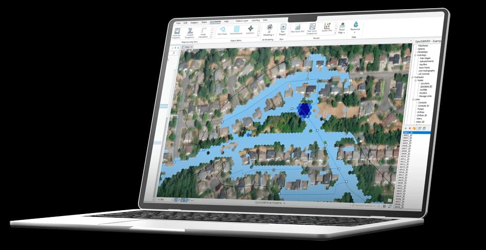
Flood modeling using GeoSWMM by Utilian in ArcGIS Pro
Residential neighborhood with houses submerged in water, which can be simulated using GeoSWMM by Utilian in ArcGIS Pro for effective flood management and climate resilience solutions
Resilient design for water management in urban areas
Suburban neighborhood affected by flooding can be modeled using GeoSWMM by Utilian for actionable hydrodynamic insights and resilient urban design

Enhance Flood Resilience
with 2D Modeling
Accurate modeling of surface water flow is critical for effective flood management in urban settings. GeoSWMM's 2D flood modeling integrates seamlessly with GIS, empowering users to simulate real-world flood pathways, storm drain overflows, and floodplain dynamics.
Develop
Prepare models quickly with GIS-based tools for watershed delineation, stormwater network setup, and data integration—ensuring accuracy from the start.
Simulate
Run advanced 1D/2D stormwater simulations to model flooding, runoff, and water quality in real-world conditions.
Visualize
Generate maps, analyze risks, and evaluate performance with ArcGIS Pro—exporting results for reporting and decision-making.


Seamlessly Build
Stormwater Models
In stormwater and sanitary sewer modeling, prepping model inputs can often be tedious and complex. GeoSWMM makes it easy with state-of-the-art preprocessing tools built on top of powerful GIS technology.


Save Time and Money
With GeoSWMM, we are constantly working to bring accuracy, efficiency, and simplicity to the modeling experience.
Check out our pricing
Quickly Master
SWMM Modeling
GeoSWMM offers the most robust stormwater modeling engine integrated with the market-leading GIS platform
Intuitive interface
ESRI's ArcGIS Pro users will feel at home with our software interface.
Learning resources
We also offer tutorials and training content to get our users going.
How GeoSWMM Can Be Used?
GeoSWMM can be used for

Stormwater and Watershed Management

Flood Risk and Climate Resilience Analysis

Dual Drainage Modeling

Water Quality Modeling

LID and BMP Design and Evaluation

Sanitary Sewer Planning

Flood Control Structure Design

Floodplain Mapping
Users Worldwide
Rely on GeoSWMM
Launch GeoSWMM
Experience the benefits of GeoSWMM—your software for stormwater and flood modeling.